Plateau
Rides

Festival 2001 Bike
Rides
Highland Adventures Guide Service,
LLC. will
coordinate several rides in the beautiful wilderness area
surrounding Wartburg. If your tastes run to hardcore mountain
biking or just a nice easy road ride (and all points in
between), you can explore the area by bike. Send
us an email and let us know if you plan to do one of
these. We will offer
specific rides based upon rider interest. Some of the
possibilities include:
Mountain Biking
Lone Mountain - Saturday
April 7 @ 10 AM
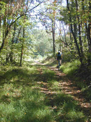
The Lone Mountain State Forest includes 3,600 acres of pine and
hardwood forest. Wildflower viewing can be spectacular on the Sawmill Trail in the Spring. Many of the trails crisscross rocky creekbeds which are mainly dry in the summer months, but make for technical riding. The 1,200' climb to Coyote Pt. from the
inters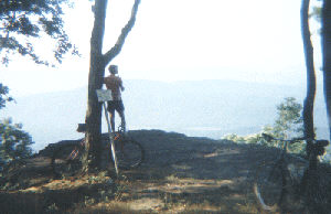 ection of Ervia Armes Rd. and the Longest Mile Trail is rewarded with stunning views of the Emory River Valley, and on a clear day one can see the Smoky Mountains. Several options are available for a
beginner-intermediate ride from the trailhead. We will have an out and back ride on Carl Black Spur or loop going out on Carl Black Spur and returning on Ervia Armes Gravel Rd. There are options here for an
intermediate to advanced (Longest Mile/Coyote Point) ride which requires good cardiovascular fitness and the ability negotiate uphill and downhill switchbacks. Sign up
via email. Meet at the intersection of Ervia Armes Rd. and the Longest Mile trailhead.
ection of Ervia Armes Rd. and the Longest Mile Trail is rewarded with stunning views of the Emory River Valley, and on a clear day one can see the Smoky Mountains. Several options are available for a
beginner-intermediate ride from the trailhead. We will have an out and back ride on Carl Black Spur or loop going out on Carl Black Spur and returning on Ervia Armes Gravel Rd. There are options here for an
intermediate to advanced (Longest Mile/Coyote Point) ride which requires good cardiovascular fitness and the ability negotiate uphill and downhill switchbacks. Sign up
via email. Meet at the intersection of Ervia Armes Rd. and the Longest Mile trailhead.
Directions to Lone Mtn: From Wartburg, follow Highway 27/29 South for approximately 4 miles. Turn west at the Lone Mountain State Forest signs (Clayton Howard Rd.) and go about 0.3 miles past the Forestry headquarters and continue 3 more miles to around to the gravel road off of Bob Armes Circle (then Ervia Armes Road) and start at the Longest Mile trailhead.
Optional Choice of Bike
Gobey Loop (All abilities) - Saturday
April 7 @ 3 PM
This is a beautiful loop along the headwaters of the Emory River which is suitable for all ability levels. It can be done on a road or mountain bike and is guaranteed to show you the best of East Tennessee's rich mountain heritage. Starting in downtown Wartburg, we will ride approximately 11 miles through the virtually untouched Gobey Valley, with it's pristine farmland surrounded by the rugged Cumberland Mountains.
Please let us know in advance via
email at or at the Highland Adventures Guide Service booth
Saturday at the
Festival.
Road Biking
Lancing Loop (Road Biking) - Sunday
April 8 @ 10 AM
If you're a roadie, and there's certainly nothing wrong with that, then join us for a ride on the Lancing Loop on Sunday morning of the festival. We'll leave from downtown Wartburg at 10:00 AM, and should be back in 2 to 2 1/2 hours. It's approximately 30 miles of undulating terrain leaving Wartburg, traveling through the historic town of Lancing, then heading North to Pilot Mountain and back to Wartburg through Annadel. It's a slice of Appalachian heaven waiting to be explored. Sign up online via email
Light refreshments will be available at the start/finish.
More About the
Area
The
Cumberland Plateau offers something for everyone who loves the
outdoors. If you are interested in mountain biking, there are
a number of nearby mountain bike trails, varying from gravel
roads to steep single track. This map
may help you locate the areas described below.
·
Frozen
Head State Park, east of Wartburg, off of highway 62 has a
gated jeep road that climbs steeply 6.6 miles to a fire tower
offering panoramic views of the Cumberlands and the Tennessee
Valley.
·
Lone
Mountain State Forest to the south of Wartburg has some
steep and challenging single-track that circles Lone Mountain.
Good views to the south are provided at Coyote Point.
·
The Catoosa
Wildlife Management Area to the west of Wartburg, offers
numerous gravel roads and some jeep roads. The roads cross the
various whitewater creeks and rivers.
·
Black
Mountain further to the southwest, at the Crab Orchard
exit of I-40, offers some challenging jeep roads. The
Cumberland Trail is also accessible from Black Mountain.
·
The Big
South Fork area to the north up US 27, provides many
mountain biking opportunities.
·
Windrock
Mountain: We have only just found out about bicycle access
to this area. Many legendary routes have been spoken about in
hushed tones through the years, but until recently we've not
been able to legally go there. Now it's changed and you can
share in its exploration.
Thanks to Tom Dunigan for his contribution of this info. Send comments or additions to Tom
Dunigan. Check out his East
Tennessee bike rides site.

