 |
|
||
|---|---|---|---|
|
|
|||
|
|
|||
|
Camping and More at
|
||||||||
 To
let you know where you can camp we’ll keep this page updated
as info develops. We’ll list the places, a brief description
and who to contact to get more info or make a reservation.
To
let you know where you can camp we’ll keep this page updated
as info develops. We’ll list the places, a brief description
and who to contact to get more info or make a reservation.| Subscribe to Tennessee Paddle News | |
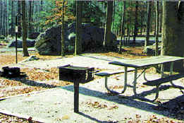
Public Campgrounds:
Nemo is now Day Use only - No Camping
- new
this year
Rock Creek Campground: 6
miles from Wartburg. Across the river from
Nemo. Managed by the Park
Service. No reservations and $7.00 per night (new).
Tables and clean port-a-johns. No water or electric.
Big
South Fork - Bandy Creek Campground:
Has tables, water, bathrooms with hot showers, electric hook? ups. Alcohol is allowed in the campground only. About 40 miles from Wartburg
Frozen
Head State Park:
Has water, toilets, showers and limited spaces. No alcohol is allowed. About 7 miles from Wartburg.
Cumberland
Mountain State Park:
It is in Crossville, TN (about 40 miles from Wartburg) Has campsites, bathrooms with hot showers and water. No alcohol allowed. There will be a $2.00 shower fee.
Melton Hill Dam: TVA property About 35 miles south of Wartburg.
Has bathrooms, hot showers, water, and electric hookups. Has picnic area and swimming area.
No alcohol allowed on property (it is government property)
East
Fork Riding Stables:
Highway 127 in Clark Range/Allart, TN.
Has all the necessary civilized amenities. Alcohol is allowed on the property.
Private Camping/Lodging
These camping spots are private properties that wonderful owners have agreed to allow us their use for the festival. They are all located near the family house. PLEASE use discretion during late hours, language and PLEASE keep their property clean!!
Each "primitive" location will be provided with a port-a-john.
Your actions will determine continued use of their properties for years to come.
PLEASE be cordial to the property owners:
Clear
Creek near Lilly Bridge
Owner: Robert
“Skeeter” Aldridge
9.5
miles from Wartburg. Take
62N out of Wartburg 6.5 miles to Ridge Road. Turn Left on
Ridge Rd. and go 3 miles. On your left will be steel gate with
Camping sign. If you reach sign for Clear Creek Retreat
you've gone too far. It is 1.5 miles
from Lilly Bridge.
Camping Site:
Primitive - in the woods
Owners: Willie and Teri Gergen
Phone (423) 346-7230
Two miles from Wartburg.
Address: 603 Heidel Rd. (not marked)
Directions: Take Kingston St. out of Wartburg toward Potter Falls. Take
first right past cemetery (Heidel Road, aka "Racetrack" road). Travel
approximately 1.6 miles to yellow house with green roof on left. Take gravel
drive on left at base of dip immediately after this house. Follow gravel
drive to end (house and garage) where you will leave your vehicle.
Willie and Teri have an excellent camp spot about 250 yards from your
vehicle. They may be available to transport gear down to and out of camp
site on their ATV.
Beautiful campsite in the woods with pond and spring . Will have to provide
your own water, or bring a water filter (plenty of water to filter). Fires
OK in designated areas. Firewood is plentiful. Port-a-john close to
campsites. Alcohol ok. Nice spot for small group of up to 10 to 14 people (6
tent sites around communal fire pit). Possibility of 2 to 3 additional
sites for 1 to 2 tents. Close to Wartburg and Festival.
Camping Site Primitive:
Owners: Al and Trudy Austin
Room for about 40 tents. It is on 107 Mac Cole Rd, 20 miles from Wartburg on Highway 62N (Go 5 miles past Lavender Bridge). Marker is Flat Rock Church on the left (maybe Baptist). Mac Cole Road is 100 yds. on the left past the
church. The owner's house is on the corner of Mac Cole Rd. and Highway 62. Park on Mac Cole Rd and camp next to your car. Two fire rings are provided for you
pyros. Port-a-Johns are available. Bring your own water. Alcohol is permitted. No camping fee is required, however, donations are accepted and these donations go to the Humane
Society and the Battered Women Foundation.
Camping Site Primitive:
Owners: Bill and Linda Black
Room for 100+ tents. 18 miles from Wartburg off Highway 62N on Claude Howard Road (Go 3.5 miles past Lavender bridge). Marker is Howard Greenhouses on left. Turn left on Claude Howard rd. Go 1.7 miles to mail box 631, left down driveway to large hayfield (with perimeter road around field). No vehicles allowed in the hayfield, but you may set up tents there. No campfires in field, but they are allowed outside field around perimeter rd. Some woods. Has
port-a-johns and water is available from the owner's well. No camping fees, however donations are accepted which are then donated to charity.
Camping
Site Primitive:
Owners:
Chuck and Cindy Retter
Address:
683 Claude Howard Rd.
(next door to Linda and Bill Black)
Take
either left at box 651 and turn left at camping field or
continue down Claude Howard Rd. to box 683 and turn left.
Alcohol is permitted.
Fires are permitted, but PLEASE use caution.
Chuck and Cindy will allow the use of their water.
Camping is free but contributions are accepted for
charitable purposes.
No email, but phone
Camping
Site Primitive:
Owners:
Steve and Valerie Hopper/Hoppers Wholesale Flowers
Address:
Barnett Bridge Rd.
Phone: (423) 965-3674
Take
62N out of Wartburg 10 miles to Island Ford Rd on left (this
is about 1 Camping
Site Primitive
- Le Mance Falls on Crooked Fork Creek: Directions: Take Highway 27 south 2 miles from Obed Wild
& Scenic Camping Site Primitive: Canoe Hole venue. 6.4 miles from Wartburg (Obed Ranger
Station). Guests
Owner: Jack
Moore (Jay) and family
Close to the Festival
Owners: Tim
and Debbie Sweat
Directions (short cut) from Wartburg (Obed Ranger Station) 6.4 mi.
total: Turn right on Maiden St. go 0.1 mi., Turn right on Old Hwy 27 go 0.8 mi., Turn left on Montgomery Rd. go 2.9 mi., Turn left on Hwy 62W go 0.4 mi., Turn left on Shady Grove Rd. go 1.7 mi., Turn right on G. Howard Rd. passing silo go 0.5 mi., Turn left onto gravel drive (private) leading into property. Check-in at farmhouse before setting up.Directions (long way but maybe faster) 7.8 mi. total: From traffic
light (Wartburg bypass) travel Hwy 62W and Hwy 27N going 3.3 mi., Turn left staying on Hwy 62W go 2.3 mi., Turn left on Shady Grove Rd. go 1.7 mi., Turn right on G. Howard Rd. passing silo go 0.5 mi., Turn left onto gravel drive (private) leading into property. Check-in at farmhouse before setting up.Don't do the camping thing?
The Scenic
River Inn located within a few minutes walk of downtown
Wartburg is ready to host you and your traveling buddies.
These won't last long so book em!
For more lodging in Wartburg and Morgan County start here
and give 'em a call.
For lodging in Oak Ridge area, east of Wartburg, using the Rt. 62 access (about 20 miles from Festival site)
check here.
Some of these folks may give you a Tennessee Paddle Festival discount. Be sure to ask.
Other opportunities are in Kingston, Harriman and Crossville from the south but we don't have them online. Those locations are near I-40 and Rt. 27.
|
© 1999 -
2000 Tennessee Paddle, All Rights Reserved |
|
